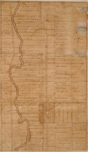
This map was drawn by James Kilbourn. The pioneers planned the way the town would be laid out even before they left Connecticut. They knew they would have a “Publick Square” (now known as the Village Green) with town lots around it. The town would be near the Whetstone River (now called the Olentangy River). They also knew there would be two roads, one running north-south and one running east-west through the Village Green. The bigger lots on this map were farm lots. Pioneers owned both town lots and farm lots.

